


NIT Rourkela Signs MoU With Survey of India to Advance Geospatial Research
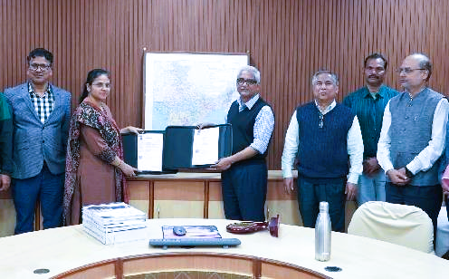
NIT Rourkela has entered into a five‑year Memorandum of Understanding (MoU) with the Survey of India’s Odisha & Chhattisgarh Geo‑Spatial Directorate to strengthen geospatial science and mapping technologies.
The collaboration aligns with the National Geospatial Policy–2022, focusing on digital mapping, climate resilience, and infrastructure development.
Under the agreement, NIT Rourkela will provide expert consultation on geodetic surveys, while the Survey of India will share its national expertise in mapping and geodesy.
The partnership also includes specialised training, higher education opportunities, and access to advanced infrastructure such as Continuously Operating Reference Stations (CORS).
Curriculum enrichment, skill development, workshops, and conferences are planned to foster knowledge exchange.
Signed by Prof. K. Umamaheshwar Rao, Director of NIT Rourkela, and Swarnima Bajpai, Director of the Geo‑Spatial Directorate, the MoU is expected to enhance India’s geospatial research ecosystem, support precision mapping, sustainable planning, and disaster risk management.