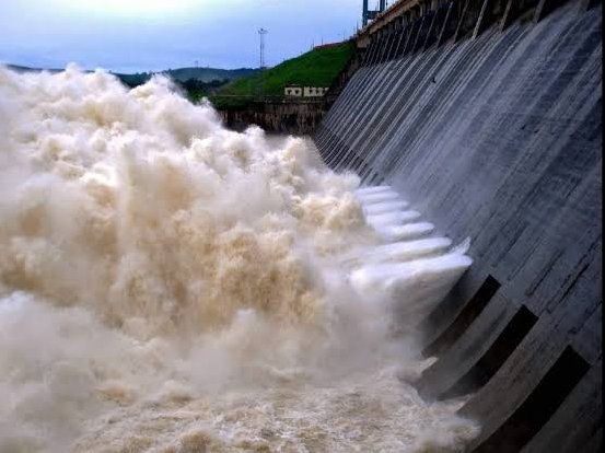
LOPAR over Bay of Bengal triggers heavy rainfall in Odisha
Bhubaneswar, Sep 2 (UNI) A low-pressure area (LOPAR) formed over the northwest Bay of Bengal today, triggering heavy rainfall across several parts of Odisha.
According to IMD sources, the system developed under the influence of an upper air cyclonic circulation over the northeast Bay of Bengal and adjoining Myanmar coast.
The low-pressure area is expected to become more marked over the same region in the next 24 hours and move west-northwestwards across Odisha during the subsequent 24 hours.
Met sources said Hatadihi in Keonjhar district recorded the highest rainfall of 23 cm, followed by Balasore and Ghasipura with 13 cm each, Thuamul Rampur with 13 cm, NH-5 Gobindpur with 12 cm, and Anandpur with 10 cm.
Several other places, including Chilika, Akhuapada, Berhampur, Bahanga, Bhograi, Chitrakonda, Baripada, Kankadahad, Nilgiri, and Bonth, also received heavy rainfall during the day.
Meanwhile, the IMD has issued a red warning for Deogarh, Sambalpur, Sundargarh, and Jharsuguda districts, predicting scattered heavy to very heavy rainfall with isolated extremely heavy falls, thunderstorms, lightning, and gusty winds reaching 30–40 kmph tomorrow.
A yellow warning has also been issued for several other districts for the next five days, forecasting heavy to very heavy rain, thunderstorms, and lightning accompanied by gusty winds (30–40 kmph) till September 6.
The IMD further warned of squally weather with wind speeds reaching 40–50 kmph, gusting up to 60 kmph, along and off the Odisha coast and over the north and west-central Bay of Bengal today and tomorrow.
Sea conditions are likely to remain rough to very rough on September 2 and 3 in these areas.
Fishermen have been advised not to venture into the sea along and off the Odisha coast, as well as into the north-west and west-central Bay of Bengal and deep-sea regions.


